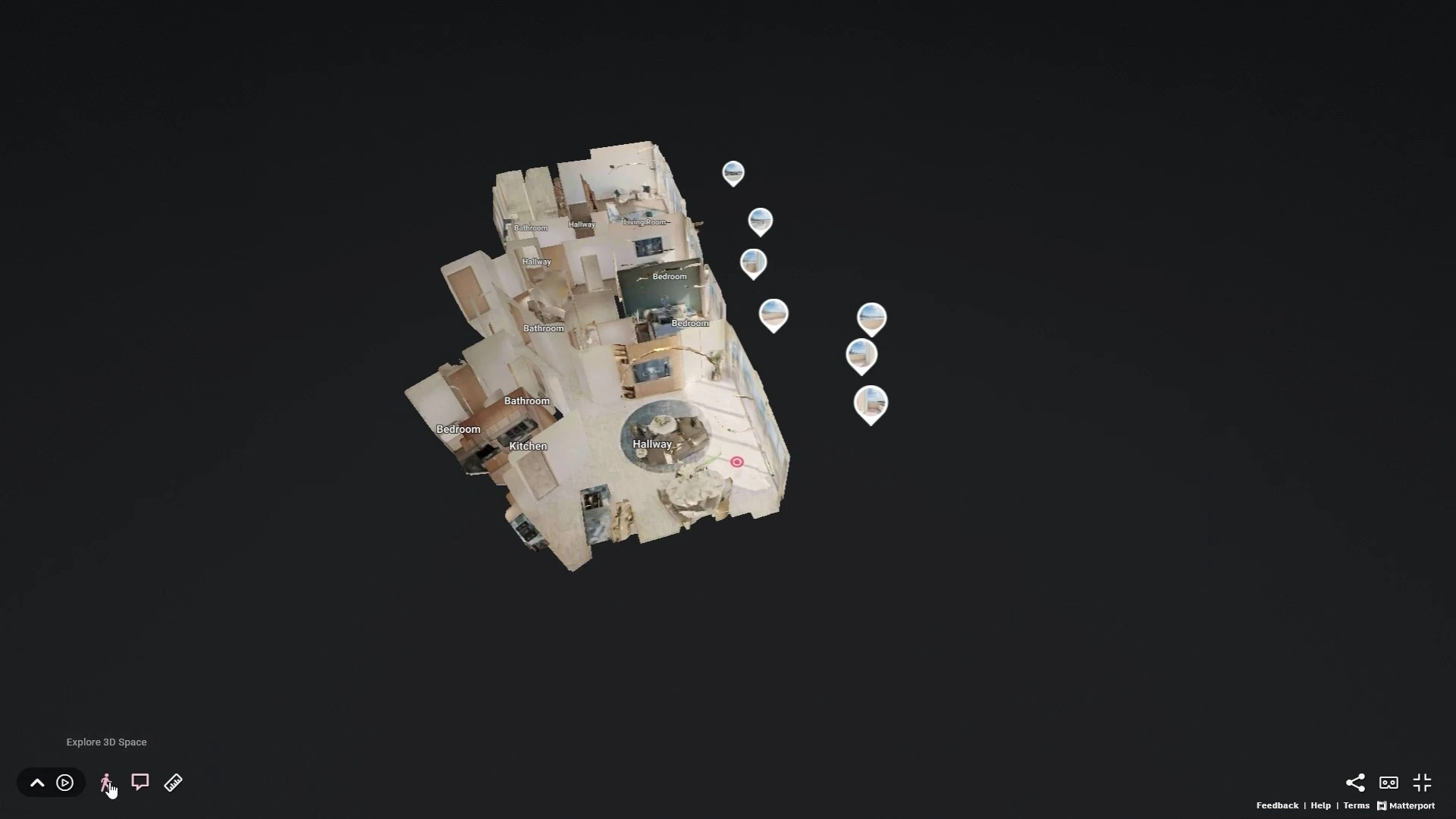
360° Virtual Tours
Every PROPVR client uses 360° capture for completed buildings and showrooms.
Every PROPVR client uses 360° capture for completed buildings and showrooms.


A 360° tours, LiDAR scanning, photogrammetry, and Gaussian splats — proven at KAFD and across every PROPVR client.
Every PROPVR client uses 360° capture for completed buildings and showrooms.
Every PROPVR client uses 360° capture for completed buildings and showrooms.
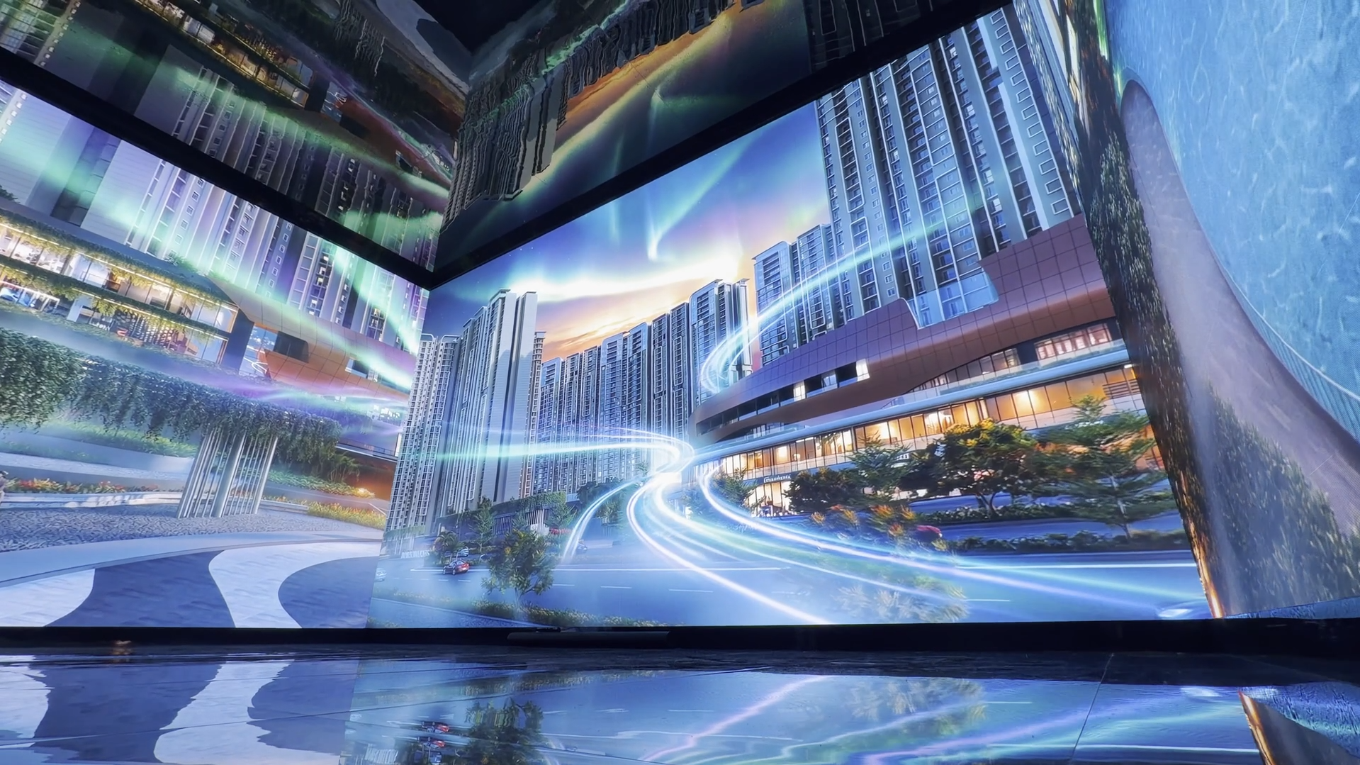
KAFD's smart-city district captured via LiDAR, drone, and converted to Unreal Engine twin.
KAFD's smart-city district captured via LiDAR, drone, and converted to Unreal Engine twin.
Photoreal 3D environments at lower data weight — web and mobile ready.
Photoreal 3D environments at lower data weight — web and mobile ready.
Insta 360, Matterport, Faro, Xgrid, drones, LiDAR — right tool, every project.
Insta 360, Matterport, Faro, Xgrid, drones, LiDAR — right tool, every project.
Captured data converts to Unreal Engine 5 — deploy across every Spatial product.
Captured data converts to Unreal Engine 5 — deploy across every Spatial product.
Reality Capture
Captures buildings and cities — converts into Unreal Engine twins powering Spatial OS, proven at KAFD.
360° virtual tours for every real-estate client, and full LiDAR-to-Unreal digital twin conversion at KAFD.
Case study 01 — Puravankara
KAFD — LiDAR-Scanned and Converted to Unreal Engine Digital Twin
“PROPVR's Spatial Twin gives KAFD a powerful tool to communicate our smart city vision — bringing the district to life for stakeholders, investors and citizens alike.”
Aqeel Bafadel · Vice President, Smart City & Innovation, KAFD
±2mm Accuracy
LiDAR District
Survey-grade LiDAR precision capturing KAFD's entire smart-city district.
6 Capture Tools
Multi-Tool Pipeline
Drone, LiDAR, Matterport, Faro, Xgrid, and Insta 360 — right tool, every project.
1 Pipeline
Unreal Engine Conversion
All captured data converts directly into Unreal Engine 5 digital twins.
Packaged offerings — launches, capture, digital twins, and gamified experiences tying software and hardware together.
Project Launches
End-to-end immersive project launch packages combining software, hardware, and content for sales galleries and events.
From scanning hardware to hosted twins — what teams ask before their first production capture.
Digitising physical assets into 3D using LiDAR, drone, photogrammetry, 360° photography, and Gaussian splat technology.
Insta 360, Matterport, Xgrid Portal Cam, Faro, drones, LiDAR cameras.
A new technology delivering photoreal 3D at lower data weight than traditional photogrammetry.
Yes — KAFD's smart-city district captured via LiDAR + drone + photogrammetry and converted to Unreal Engine twin.
Every PROPVR real-estate client uses 360° virtual tour capture.